TempO Simulator - Event Preparation Instructions


What to do if you want to add a race to our Simulator:
- Write to temposim@yq.cz.
You might suggest a race identifier directly
(see Organizational instructions).
- Take pictures of stations.
Especially beware of sharpness and distortion of the pictures.
- Prepare image files for the race
(find a suitable cut-out, check and adjust or add flags
and possibly markers, etc.).
In a normal case, only the zoom format is needed.
- Plan courses.
Keep in mind that the race in a photo is something other than in real life.
- Prepare maps.
The most suitable tool is OCAD+TiM, or OrienteeringMapper+TOM.
Check the readability carefully; sometimes it is necessary to modify the map.
- Pack the files, send them using a form
(see Organizational instructions),
and test the race.
Repeat steps 2 to 6 until everything is perfect.
We recommend starting with one station only and tuning the process on it.
However, it is better to bring more photographed locations from the forest,
so you have a backup in case some are too difficult to solve.
- It is necessary to take all pictures from (almost) exactly the same spot
where real competitors would solve the task.
Carefully note the precise location of the "chair" on the map!
This is important for correct map rotation.
- For the problems to be solvable at all,
the pictures must include not only all the flags
but also all surrounding objects that competitors may use
to precisely locate flags or estimate distances.
Keep in mind that real competitors know which way they came to the station,
while a computer user has no idea
about the position of the photographer.
- Carefully check that the images are sharp enough,
especially around controls or important objects
(trees, stones, building corners, etc.).
- If your camera has a wide-angle lens
or a "panoramic picture" function, you can try to cover the entire scene
with a single picture.
However, in this case, you should check the result thoroughly
for undue distortion.
- If you can't cover the scene with a single image,
you will need to take a series of pictures to be stitched together.
We have good experiences with the program Hugin,
but you should follow some guidelines:
- Try to get about 30% overlap between shots,
so we'll have enough details to stitch the images together.
Some lenses (e.g., wide-angle ones) have blurry performance
near the edges, so it may be best to overlap even more.
It's an advantage if every flag is close to the center
of some picture.
- If your camera allows you to specify
a "Manual" exposure mode, use it.
Meter for the average or the brightest area of the cluster,
and use the same metering for all images of the set.
It is possible to take two series of pictures,
one for depicting light areas, the other for shadows.
- Even in automatic mode, the pictures can be acceptable,
but the results
can be much worse when part of the scene is light and another dark.
Try to fix the exposure to a single point for all pictures —
most cameras allow you to prepare the exposure by pressing
the shutter button halfway and then moving the view
to the desired part of the scene.
- When taking all pictures, hold the camera at the same angle
from a horizontal level (using a tripod is recommended).
- We take a picture of a station,
check the visibility of the flags, and
select a proper cutout needed for solving all the tasks.
For normal scenes, an ideal sides ratio is 4:1.
For a regular photo, this means that the usually insignificant
top of the photo, containing only the sky or treetops, needs to be cut off.
- We resize the picture so that the surroundings of all flags
are well visible and the target file has no more than two or three MB
(choose JPG format for pictures, not PNG).
A typical suitable size of the picture is 3–4Mpx
(i.e. e.g., 4000x900 or 3000x1300).
We save the picture to a file
imgSTATz.EXT
(STAT is a placeholder for a station number,
EXT means extension – jpg).
This will be our basic picture, so called zoom file.
- We carefully check the visibility of individual flags,
sticks (if it is important for solving a task),
and other important objects.
If the visibility is poor somewhere, we
must try to fix the image in some graphics editor (e.g., GIMP).
We should also try to delete all distracting elements —
a pedestrian in a red jacket, a red car, white posters, etc.
It is also necessary to blur or mask any accidentally taken faces,
license plates, etc.
- If all the flags are not clearly visible at first glance,
we use a graphics editor and add vertical red/white bars or
markers pointing to the flags
on top of the picture.
- By default, the Simulator checks the window size, splits the height
in a ratio of 55:45 to a part for a picture and a map,
and resizes properly the zoom file.
- If you take pictures without flags and add them there ex post,
some additional principles need to be followed:
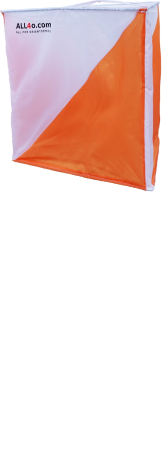
- Use a suitable image (for example, this one
given to us by Matthew Pickering)
- Proportionally scale down more distant flags.
It is ideal to take a photo of the area with and without flags,
even if you know you will want to add the flags
in a graphic editor.
The real flags will help you estimate the exact size you need
to use for the virtual flags.
- Pay attention to the most accurate placement
of the stick foot!
- If in reality a flag or stick is partly covered
(by a branch, bank, terrain, etc.),
we should cover or remove an appropriate
part of the flag or stick accordingly.
- If a real flag was in the shade,
darken the artificial flag as well!
- If you have the slightest doubt about the "real" position of a flag,
we recommend showing the picture
to an independent person
and asking them about where the flag is.
- If the angle of the picture is greater than 120 degrees,
you must mention it in the pre-race information,
and it is highly recommended to place a warning
("viewing angle > 120 degrees") also
directly on the picture.
- If you are an event organizer, the optimal approach is to make
both the map and the courses in OCAD for
TiM.
- If you are not using OCAD + TiM or are not an organizer
and the data cannot be obtained from the organizers,
we need some more material:
- Competition maps enlarged to 150 %
(control circle diameter 9 mm)
with height max. 300 px depicting the entire necessary area
(both the decision point and the most distant flag
including a small vicinity around it),
control description and a North arrow.
The file name should be
map-STAT.TASKz.EXT
and usual size of 1000x300 px and max 200 kB.
- Cover sheets for each station.
Competitors greatly appreciate seeing a North arrow
(and possibly the outline of a future map)
even before the first task.
So we recommend preparing files with the same size as maps
and names map-STAT.0z.EXT.
- Solution maps for each station in files
sol-STAT.EXT;
usual size of 400x400 px and max 200 kB.
If you cut them from a "standard" solution map and there are
two clusters very close togeher,
you can make a common solution map for them.
A suitable alternative to TiM is the program
TOM.
- Pay attention to the scale of the map!
If you enlarge it from a non-sprint foot-o map, you have two options:
- Do not allow OCAD to enlarge symbols when changing the scale
(there is a checkbox at the appropriate operation),
or make the change and afterwards
reduce the symbols on the map accordingly
to match the map at the target scale.
After resizing the symbols, it is necessary to check whether
their relationships on the map have not been broken
(namely distances and directions).
- An alternative,
albeit highly unrecommended
approach is not only to indicate the final scale
in the Map description in the race info,
but also to emphasize the fact that the map has been enlarged
without appropriate changes.
In that case, however, it is necessary to check
whether these deficiencies of the map
do not affect the solvability of tasks.
However, the control circles must still have
the correct radius (3 mm).
- All map files must have the same extension.
- When preparing an online race, it is necessary to keep in mind
that compared to real races, competitors have a difficult position:
- They know nothing about the surroundings of the decision point.
- They do not have a plastic view
(feeling a picture depth), so it is not able to recognize
a Zero based on the fact that at the 70 m task,
the flag is moved forward by 5 m.
- If possible, avoid "in front of a fence" / "behind a fence" tasks,
which can be solved very hardly from a photo.
- The wider the picture range we use, the greater the distortion
at the edges is, and this can lead to unsolvability of problems.
- If a control is close to the edge of a picture, carefully check
that there are enough clues in the photo to solve it.
- Avoid "dirty" tricks like using some false shadows.
If you use a trick where one object is hidden behind another or
out of picture, carefully check whether competitors have a chance
to reveal the trick (they see well object shapes, surrounding objects,
there is no picture distortion, etc.).
- Because you usually take a photo before making a competition map,
you don't know the exact angle at which the map will be rotated.
Therefore, make sure that the direction of rotation of the map
does not differ too much from the direction
in which the photo was taken.
The most common cause of a large deviation
is the placement of flags A or F too close to the decision point.
If the map rotation differs significantly,
you need to adjust the map rotation angle.
If you use TiM, you will find the rotation calculated and used by him
for each station in the information window.
If the rotation needs to be changed,
enter the calculated rotation with a minus sign in the Station/MinAngle
configuration for the given station
and adjust the value accordingly.
- Avoid "dirty" tricks such as using a false shadow.
If you use a trick where one object is hidden behind another
or out of the frame, carefully check whether the competitor has a chance
to detect the trick (can they see the shapes of the objects clearly,
surrounding objects, the photo is not distorted, etc.).
- Try to solve tasks on a smaller monitor (1200 px) to ensure
competitors with such a monitor do not have a decisive disadvantage.
- If you want to prepare a new Simulator race, you must suggest an identifier.
The ideal one is a combination of a place and a year, e.g.
Honolulu_2020.
After receiving the identifier, we can create a race for you.
- We made a totally simple HTML form,
using which you can upload the files and other data directly to the server
and test them immediately in the Simulator.
- The form also allows adding and modifying other data about the race, like
authors, instructions, correct answers, etc.
- The files are to be uploaded in a ZIP or RAR package that contains
all the above mentioned files.
When you repeat an upload, only new and changed files should be included
in the package.
- This package can also contain a logo that will be drawn on the first
page of the event and in the list of events.
If you want just a single logo, its name will be logob.EXT,
if you want two logos (left and right) then the names will be
logol.EXT and logor.EXT.
If you want to avoid the browser from resizing your logo automatically
in the list of events, you can also prepare
a logo with a height of 32 px named logoi.EXT.
All these files must have the same extension.
Sample package content: